History
The contrast between this salt-producing region that straddled Salt River and the rest of Kentucky at this early date was so great that it is almost incomprehensible. Salt was beginning to be produced at a few other places throughout the state, but nowhere was there such a concentration of wells and furnaces. Hundreds of men were employed as woodchoppers, waggoneers, kettle tenders, and water drawers. Many more, such as hunters, storekeepers, coopers, and carpenters were directly involved. Merchants, traders, and private individuals came from all over the wilderness to procure the precious salt.
Salt was sent by pack train, flatboat, and canoe to one end of the wilderness to the other. Bullitt’s Lick must have taken on something of the nature of a boomtown—a startling, unbelievable sight to the hunters in from the deep woods and to the settlers from their lonely clearings.
 Thomas Perkins from Lincoln County wrote in a letter on February 27, 1785, “I have seen but one spring of consequence in this district which is at a place called Bullitt’s Lick on a small branch of Salt River . . . At this spring, by the best information I could get, about 40 gallons of water will produce a bushel of salt. At the distance of a quarter of a mile from the spring is a small mountain 30 or 35 feet deep, and that the nearer they approach the mountain, the stronger the water is impregnated with salt.” Perkins indicated that the salt was sold at $3.00 per bushel.
The furnaces were long trenches dug back along the top of a bank. They were walled with slate about 15 inches thick, which was laid with a mortar of clay. The kettles themselves held about 22 gallons each and they sat on top of this trench in a row, with as many as fifty in the string. The furnace was fired from in front; the flames and smoke sucked under the kettles and out through a stone chimney at the far end of the pit. Generally, they were protected from the elements by a shed roof supported on poles. It was quite common for two of these long narrow furnace pits to be under a single roof. The water was boiled for about twenty-four hours, then transferred to a cooler—a trough, which acted as sort of a settling tank. Then the clear, saturated brine was drawn off into the kettles again, and boiled rapidly until it began to grain. Sometimes blood was added to purify the water or the white of an egg.
Paroquet Springs
This was a mineral water spa that enjoyed a long period of popularity in Kentucky and throughout parts of the south. The water was thought to have medicinal properties that could cure a variety of illnesses. Many people came to Shepherdsville for the season, which usually was from June through August. Here they would drink and bathe in the mineral water. The first development of the springs began in 1838 when 20 acres were opened with accommodations for about 200 people. Over time, the grounds were further developed, and more people could be cared for. The Civil War Caused the restriction of travel and thus a corresponding decline of Paroquet. In 1871, a group of investors from Louisville tried to revive the springs. A new hotel was built and accommodations for up to 800 people developed. This revived popularity was short lived because the hotel burned to the ground in 1879. The water was still sold until circa 1915, and the old buildings were still used for several years after the fire, however the height of Paroquet’s popularity was just prior to the Civil War.
America’s Civil War
The railroad participated in the war by transporting troops and equipment as well as produce and goods both north and south of Bullitt County. Railroad property, including the bridges at Shepherdsville and Lebanon Junction were frequent objects for destruction by Confederate troops. Many Bullitt County men fought for both sides.
1900 to 1910
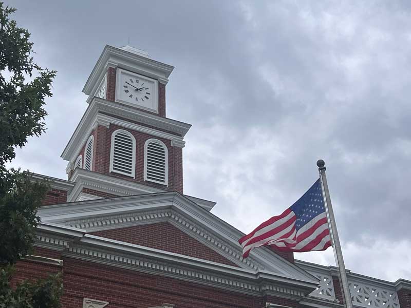
A new courthouse was constructed in 1900. Modern road bridges were constructed across the Salt River at Shepherdsville and Greenwell Ford. Many smaller bridges were constructed during this period also.
From 1900 until 1950, Bullitt County and Shepherdsville remained primarily an agricultural area. The population remained about the same with little economic development. During the 1950’s, the Kentucky Turnpike was constructed from Louisville to Elizabethtown. The turnpike was a modern 4-lane limited-access highway. There was a full interchange and toll booth at Shepherdsville and a limited interchange at Lebanon Junction. The road changed the area. Quicker access to Louisville caused people in Louisville and Jefferson County to move to Bullitt County. New businesses were opened, and small industry began to move in.
During the 1980’s the Federal Interstate Highway System was developed. The Kentucky Turnpike was made a part of this system. New markets came to the county and economic development continued at a greater pace. By the year 2000, plans were made for three new industrial parks.
Additional History
The first inhabitants of the land that would become Bullitt County were the Paleo-Indians who entered North America approximately 11,500 to 10,000 years B.C. These people, whose ancestors can be traced back to Eastern and Central Asia, were nomadic. They were hunters and gatherers whose remains have been discovered near the area’s mineral springs or salt licks, where big game such as the mammoth, bison and ground sloth once gathered. Native Americans were their descendants, including the Shawnee people, who probably considered this region part of their homeland and certainly valued it as a hunting ground.
Both France and Britain had traders and colonists who encountered the Shawnee. European colonization of the Americas led to competing claims between those nations to the land west of the Appalachians and east of the Mississippi River. After suffering defeat by Great Britain in the Seven Years’ War (known as the French and Indian War in its North American front), France ceded control in 1763 of its claimed territories.
For thousands of years before the county’s formation, nutrient-rich salt licks attracted large herds of bison and other game to the area. Native American tribes made it their hunting grounds, as did the 18th century long hunter. In 1773, after the French and Indian War, the Virginia governor sent Captain Thomas Bullitt (uncle to Alexander Scott Bullitt) into the area to survey for land grants. The most historic of the county’s salt licks, Bullitt’s Lick, is named after him. As the Revolutionary War led to widespread salt shortages, the Lick became the site of Kentucky’s first industry, attracting many settlers to the area.
Colonial veterans of the war were promised land in what was later called Kentucky. Bullitt’s Lick became an important salt work to the region; its salt was harvested and sent by pack train and flatboat as far off as Illinois to the west. The Bullitt’s Lick salt work was one of Kentucky’s first industries and in production until around 1830. By that time, the steamboat and importing of salt brought access to less expensive sources.
The first settlement of the area was also the first station on the Wilderness Road between Harrodsburg and the Falls of the Ohio. It was a fort called Brashear’s Station or the Salt River Garrison, built in 1779 at the mouth of Floyd’s Fork. Most of the county was settled after the American Revolutionary War. Shepherdsville, named after Adam Shepherd, a prosperous businessman who purchased the land near the Falls of Salt River in 1793, is the oldest town and became the county seat.
In December 1796 the county of Bullitt, named after Thomas Bullitt’s nephew and Kentucky’s first Lieutenant Governor Alexander Scott Bullitt, was organized from land taken from Jefferson and Nelson counties through an act approved on December 13, 1796, by the Kentucky General Assembly. In 1811, the northwestern area of the county expanded to include land given by Jefferson County. In 1824, an eastern area of the county was given to help form Spencer County.
Be it enacted by the General Assembly, That from and after the first day of January next, all that part of the counties of Jefferson and Nelson included in the following bounds.. shall be one distinct county and called and known by the name of Bullitt. ”
— Kentucky General Assembly, December 13, 1796
City Flag
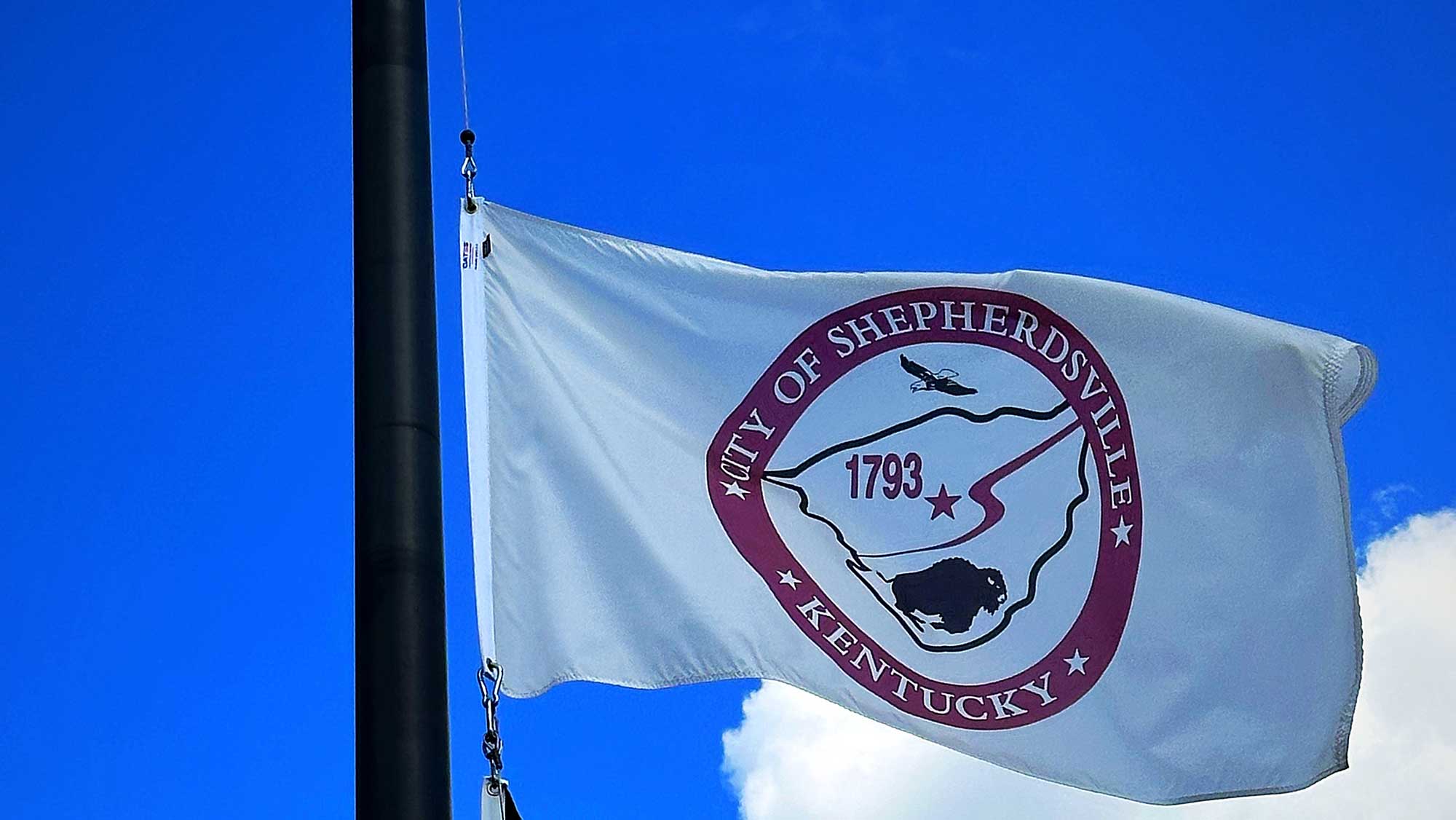
 The City flag originated with a flag contest in the fall of 2000 where the best entrants were awarded prizes. The Mayor and City Administrator worked with a flag vendor to come up with a suitable design and it was presented to the City Council for their approval.
It has a white background with a maroon circle containing the words “City of Shepherdsville Kentucky” with stars around the words. The words are shaded and show the name of our town. There is an inner white circle that contains the shape of the county in black. The number “1793” is in maroon to symbolize the founding date of the city: December 11, 1793. Next to the number is a maroon star symbolizing the location of the City within Bullitt County. The Salt River runs through Shepherdsville and the county, and it is recognized with a curved line in maroon. Below the river and other items is a buffalo to symbolize Shepherdsville’s early origins with the Buffalo Trail in pursuit of the salt in the area. Above the county outline and still within the circle is an American Bald Eagle in flight. This is to remind us of our freedom and to remember all those who sacrificed for preservation of it.

